- ¡En oferta!
- Solicitar Info

Enviamos a todo Mexico. Favor de solicitar su cotizacion por Telefono.
Tambien puede recoger su pedido en nuestras oficinas fisicas. Consultar direccion de oficinas Trumon.
Características:
Incluye:
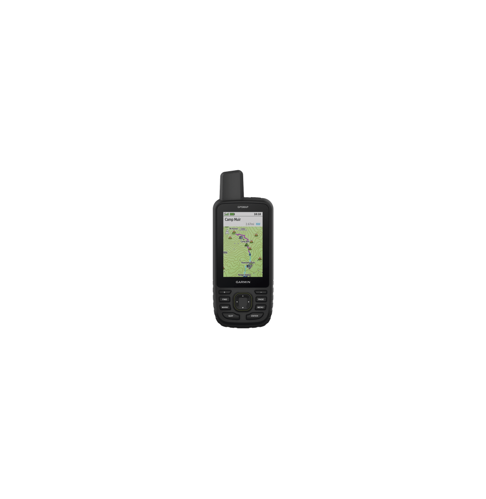
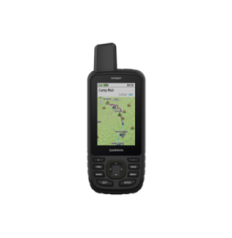
Dimensiones: 6 2 x 16 3 x 3 5 cm (2 5″ x 6 4″ x 1 4″)
Peso: 230g
MAPAS Y MEMORIA.
| MAPAS PREINSTALADOS | Sí (TopoActive de EE. UU. México y Canadá con rutas) |
|---|---|
| POSIBILIDAD DE AGREGAR MAPAS | SI |
| MAPA BASE | SI |
| CREACIÓN AUTOMÁTICA DE RUTAS (GIRO A GIRO EN CARRETERA) | SI |
| SEGMENTOS DEL MAPA | 15000 |
| BIRDSEYE | Sí (directamente al dispositivo) |
| INCLUYE CARACTERÍSTICAS HIDROGRÁFICAS DETALLADAS (LITORALES LÍNEAS DE COSTA DE RÍOS O LAGOS HUMEDALES ARROYOS PERENNES Y ESTACIONALES). | SI |
| INCLUYE BÚSQUEDAS DE PUNTOS DE INTERÉS (PARQUES CAMPINGS MIRADORES PANORÁMICOS Y SITIOS DE PÍCNIC). | SI |
| MUESTRA PARQUES NACIONALES ESTATALES Y LOCALES BOSQUES Y ÁREAS NATURALES. | SI |
| ALMACENAMIENTO Y CAPACIDAD DE CARGA | Sí (tarjeta microSD™ de 32 GB como máximo) |
| WAYPOINTS | 10000 |
| TRAYECTOS | 250 200 puntos de trayecto por trayecto |
| PISTAS | 250 |
| TRACK LOG | 20000 puntos 250 tracks gpx guardados 300 actividades de ejercicio guardadas |
| ACTIVIDADES | Sí |
| RUTAS | 250 250 puntos por ruta; 50 puntos de rutas automáticas |
SENSORES
| ECEPTOR DE ALTA SENSIBILIDAD | SI |
|---|---|
| GPS | SI |
| GLONASS | SI |
| GALILEO | SI |
| QZSS | SI |
| BEIDOU | SI |
| IRNSS | SI |
| ALTÍMETRO BAROMÉTRICO | SI |
| BRÚJULA | Sí (tres ejes con inclinación compensada) |
| BRÚJULA GPS (MIENTRAS SE ESTÁ EN MOVIMIENTO) | SI |
| FRECUENCIA MULTIBANDA | SI |
05-04-2025 18:55:12 SSN7 U-0
Envío a Domicilio. Enviamos a todo México; Villahermosa, Tuxtla, Oaxaca, Veracruz, Acapulco, Colima, Manzanillo, Aguascalientes, Tampico, Fresnillo, Mazatlán, Reynosa, Ciudad Victoria, Durango, Culiacán, La Paz, Tijuana, Mexicali, Nogales, Juárez, Monclóva, Monterrey y más.